
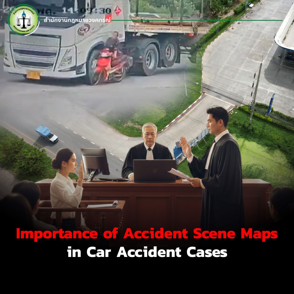
When a road accident occurs whether it involves a private car, motorcycle, truck, or even public transportation one of the most critical pieces of evidence required by all parties, including the police, courts, lawyers, and insurance companies, is the accident scene map.
This map is not merely a rough sketch of the collision site; rather, it is an essential tool used to prove facts and illustrate the sequence of events systematically, which can directly affect the judgment of who is at fault.
Importance of Accident Scene Maps in Car Accident Cases
Accident scene maps are vital documents frequently included in investigation reports and court proceedings because they serve to:
- Verify the positions of vehicles and persons involved: Showing where each vehicle was at the time of the incident.
- Indicate directions of movement: Helping determine which driver may have been negligent.
- Record surrounding conditions: Such as traffic signals, road markings, signage, pedestrian crossings, or obstacles.
- Serve as legal evidence: Courts and lawyers rely on accident maps to explain and present cases before judges.
Many car accident cases have been overturned or weakened simply because the accident map was incomplete or lacked crucial details, preventing victims from fully proving their rights. Therefore, preparing an accurate accident map is a process that must not be overlooked.
Why Are Drones Important for Creating Accident Scene Maps?
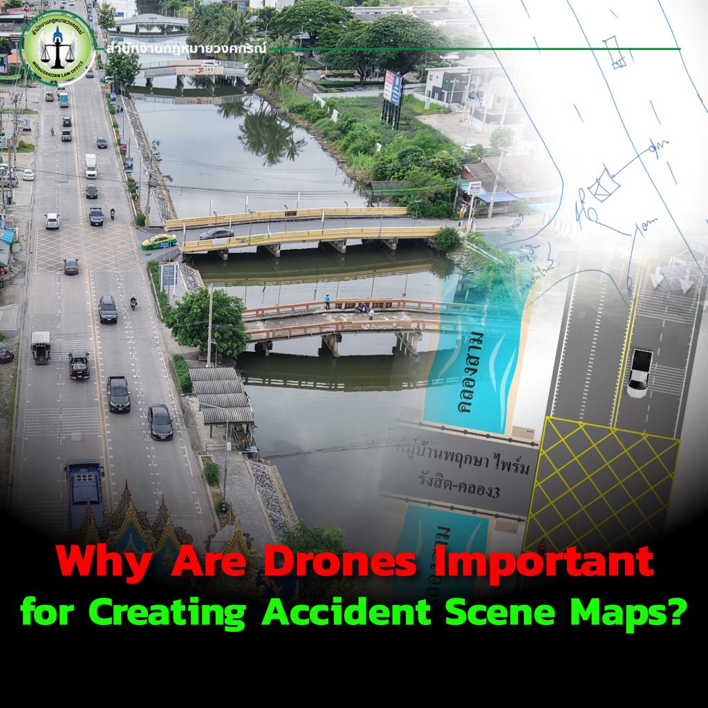
Traditionally, accident maps were drawn by hand or based on ground-level photographs, which often lacked clarity and detail. With the advent of drone technology, accident scene mapping has become more precise and effective.
1.Aerial Perspective
Drones capture images from above, providing a clear overview of the accident site. This includes roads, collision points, traffic signals, and surrounding environments all in a single frame greatly improving analysis accuracy.
2.High Resolution and Precision
Drone imagery can capture details down to the centimeter level. This is invaluable for verifying collision points, brake marks, or skid traces that may not be visible from the ground. These images can also be processed into digital maps for legal use.
3.3D Mapping
Modern technology allows drone footage to be processed into 3D maps that realistically illustrate the accident scene. This helps courts and lawyers understand the sequence of events more easily and can even support accident re-enactments.
4.Reducing On-Site Risks
Accident sites are sometimes dangerous or congested. Using drones eliminates the need for ground personnel to measure or record details directly, thereby reducing risk.
The Lawyer’s Role in Using Drone-Based Accident Maps

Having an accurate accident scene map serves as a critical legal weapon in litigation. With drone data, lawyers can:
- Analyze the driving behaviors of all parties in detail.
- Present clear and indisputable evidence in court, rather than relying solely on testimonies.
- Increase credibility when negotiating compensation with insurance companies.
In other words, drone-based accident maps are not just photographs; they are tools that enhance the victim’s chances of obtaining justice.
Comparison: Graphic Maps vs. Drone-Based Maps
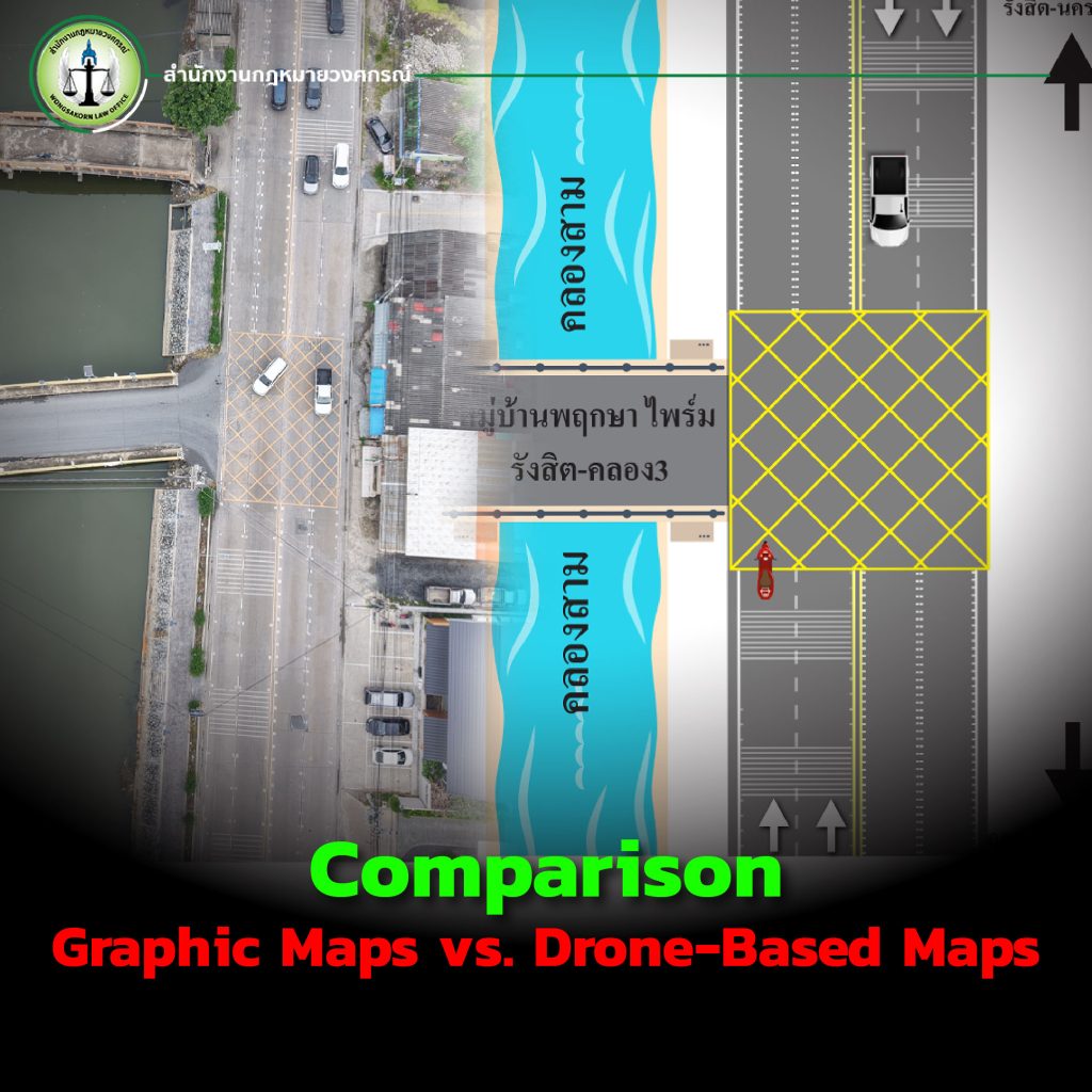
1.Accuracy
o Graphic: Manually drawn, often prone to errors, especially with small details (brake marks, distances, collision angles).
o Drone: Provides actual aerial images with precise data, reducing misinterpretation.
2.Completeness of Perspective
o Graphic: Usually limited to 2D diagrams, giving only a rough overview.
o Drone: Offers a full aerial view and can be developed into 3D models.
3.Credibility in Court
o Graphic: May be questioned for accuracy since it is a reconstruction.
o Drone: Supported by real photographic evidence, highly credible.
4.Convenience
o Graphic: Time-consuming, requiring manual measurements and sketches.
o Drone: Captures complete images within minutes and processes them into usable maps.
5.Cost
o Graphic: Cheaper but less reliable.
o Drone: Slightly more expensive, but well worth the quality and legal strength it provides.
Conclusion: Drone-based accident maps surpass graphic maps in accuracy, reliability, and completeness, making them ideal for car accident cases where solid evidence is essential.
Drone Accident Mapping Services by Wongsakorn Law Office

To ensure that victims receive true justice, Wongsakorn Law Office has established a specialized team providing drone mapping services for road accident cases. The team is led by Pol. Lt. Pisuth Ritkajorn, Deputy Inspector of Planning Division 3, Office of the Commissioner-General, Royal Thai Police, together with certified drone aviation experts. All team members have been officially accredited by the Civil Aviation Authority of Thailand (CAAT), ensuring legality, safety, and the highest quality of work.
With extensive experience in both litigation and using drone-based evidence, we provide professional support whether you are a victim seeking compensation or a defendant proving your innocence.
Accident scene maps are decisive evidence in car accident trials. Using drones ensures fact-finding is accurate, complete, and credible compared to traditional methods.
👉 If you are facing a car accident case and need strong evidence, choosing Wongsakorn Law Office’s Drone Accident Mapping Service is the key to confidently achieving justice.